
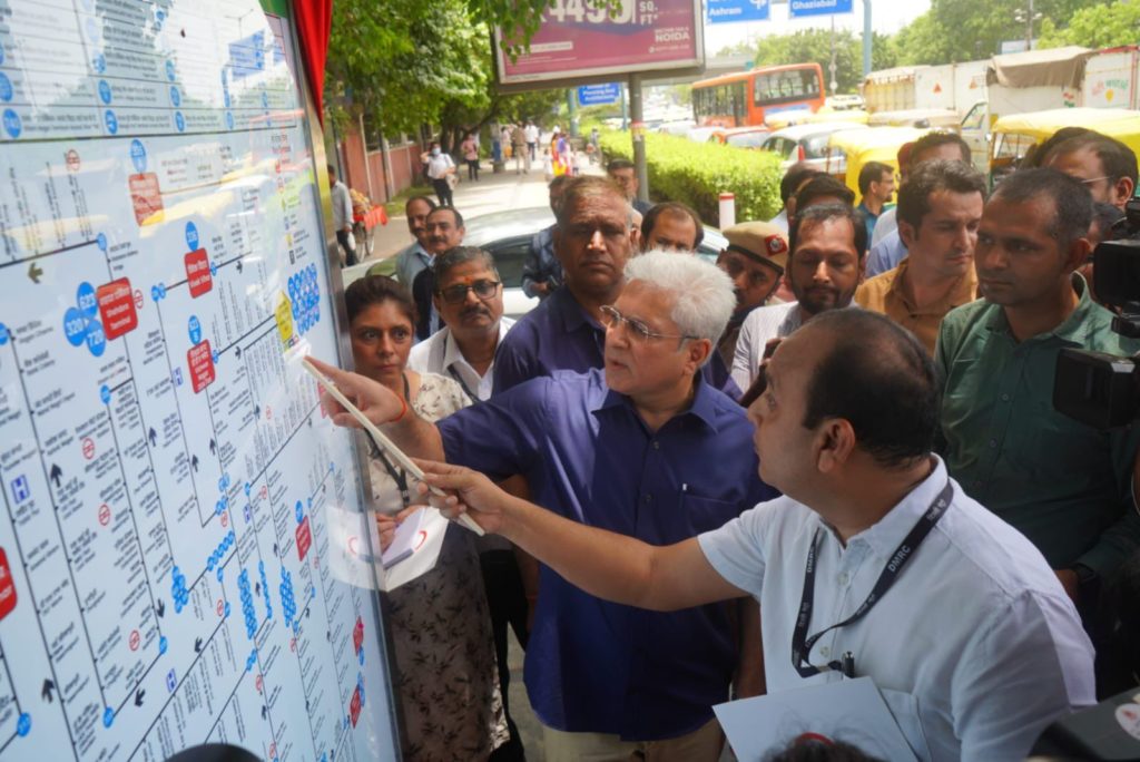
Delhi’s public transportation system gets an upgrade as Transport Minister Shri Kailash Gahlot inaugurated the state-of-the-art Bus Route Navigation map installed at the Bus Queue Shelter (BQS) at ITO. These Bus Route Navigation maps are being installed in partnership with Delhi Metro Rail Corporation (DMRC) at 2000 BQS in Delhi. The Delhi Government shall be spending Rs 27 crores on the same, including 3 years of maintenance.
Speaking at the occasion, Shri Kailash Gahlot said “Under the visionary leadership of Chief Minister Shri Arvind Kejriwal, the Delhi government is revolutionizing public transportation. A bus traveller, especially an occasional traveller, is often confused as to which bus will go where and the problem is further increased if one has to change buses in between. With these maps located at BQS, one can easily get a complete idea of the bus route number and the destinations. These maps use both Hindi and English, making it comfortable to be read by anyone. With world class electric buses plying on the road, this is another step in making public transportation more convenient.”
The Delhi Government has partnered with DMRC to install large-sized route maps at the BQS. DMRC will be building the stainless steel frame along with the Backlit Route Map at these BQS. These Bus Route Navigation maps will be 4 ft wide and 6 ft high. DMRC will execute this project across Delhi in the next 6 months. The overall project will include 3-year complete maintenance of these Bus Route Navigation maps.
The innovative Bus Route Navigation Map promises to enhance accessibility, convenience, and efficiency for commuters, providing them with accurate information and ensuring smoother journeys across the city.
Benefits of the new route map:
- Easy Navigation: The route map enables commuters to easily identify the appropriate bus route and destination while waiting at the BQS. This eliminates confusion and simplifies the process of choosing the right bus for their journey, saving time and effort.
- Seamless Intermodal Travel: By incorporating information about nearby Metro stations, the route map facilitates smooth intermodal travel, allowing commuters to seamlessly transition between buses and the Metro. This integration promotes a more efficient and interconnected transportation system.
- Access to Important Facilities: The inclusion of information about ISBTs, hospitals, and railway stations along the route helps commuters easily identify nearby facilities. This proves particularly beneficial for those unfamiliar with the area, providing them with essential information for their travel needs.
- Enhanced Convenience: The large size of the route maps ensures that they are easily visible to anyone at the BQS. This makes it convenient for commuters to read and understand the displayed information without straining their eyes, further enhancing the overall commuting experience.
Looking ahead, the Delhi government is also working on implementing a Passenger Information System (PIS) at the BQS which will be similar to displays found at railway stations or airports. The PIS will provide real-time information on the exact arrival time of the next bus at the BQS, further enhancing the convenience of bus travel for commuters.
The introduction of these route maps and future plans for the Passenger Information System demonstrate the Delhi government’s commitment to transforming public transportation, making it more accessible and efficient for the residents of the city.